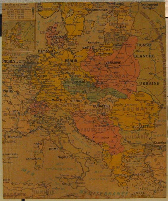
map (mounted on cardboard) showing Central Europe and Russia
Production date
Circa 1930s
See full details
Details
Description
Large map (mounted on cardboard) showing Central Europe and Russia (France, Germany, Poland, Austria, Hungary, Yugoslavia, Romania, Bulgaria, Greece, Russia, Turkey, Norway, Sweden amd Finland). Names are in French. Used by the Message and Tracing team during and after the Second World War to help with establishing country of origin of people displaced by war. Used until the move from Grosvenor Crescent in December 2004No details on publisher or date. No details on publisher or date. Maps shows principal capital cities, towns and frontiers.
Collection Type
Objects
Catalogue Number
2344/2
Subject auto tags
Object Types
Share
All images are the property of the British Red Cross Museum and Archives (unless otherwise indicated), and cannot be used without permission. For queries about permission to use images, please contact enquiry@redcross.org.uk.