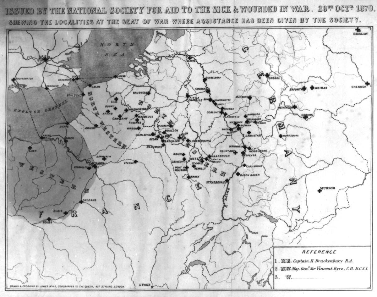
Map illustrating the relief provided by the British National Society for Aid to Sick and Wounded in War during the Franco-Prussian War, 1870
Production date
1870
Audio tour
See full details
Details
Description
This map was issued by the British National Society for Aid to the Sick and Wounded in War on 6th of December 1870. It shows localities in which personal or material aid has been given by the Society to French or German soldiers during the Franco-Prussian War. The different coloured areas refer to geographical districts, whilst the plus symbol locates precisely the points to which financial help has been sent.
Drawn and engraved by James Wyld, geographer to Queen Victoria, this map functions as an illustrative record of the involvement of the British National Society for Aid to the Sick and Wounded in War (later renamed the British Red Cross), in the war zones of the Franco-Prussian conflict. This map provides us with additional information on the Franco-Prussian War. It records the exact involvement of the British Red Cross in the war zones and shows its geographical impact in helping soldiers and civilians affected by the war.
I was particularly drawn to this object as it depicts the first involvement of the British Red Cross in a conflict zone. It was the organisation’s first ever piece of work, and the British Red Cross was founded partially as a response to this conflict. Whilst the British Red Cross was one of several European organisations aiming to provide medical assistance active during the Franco-Prussian War, European nations commonly shared the desire to reduce the rate of death and help casualties during conflicts. Their efforts were proven highly effective and subsequently were replicated in further armed conflicts up to today.
Audio recording by Polina Chizhova (Volunteer), Edinburgh.
Collection Type
Archives
Level of Current Record
item
Catalogue Number
IN0095
Subject auto tags
Object Types
Part of 1 highlight set
-1%20(002).jpg)
Share
All images are the property of the British Red Cross Museum and Archives (unless otherwise indicated), and cannot be used without permission. For queries about permission to use images, please contact enquiry@redcross.org.uk.