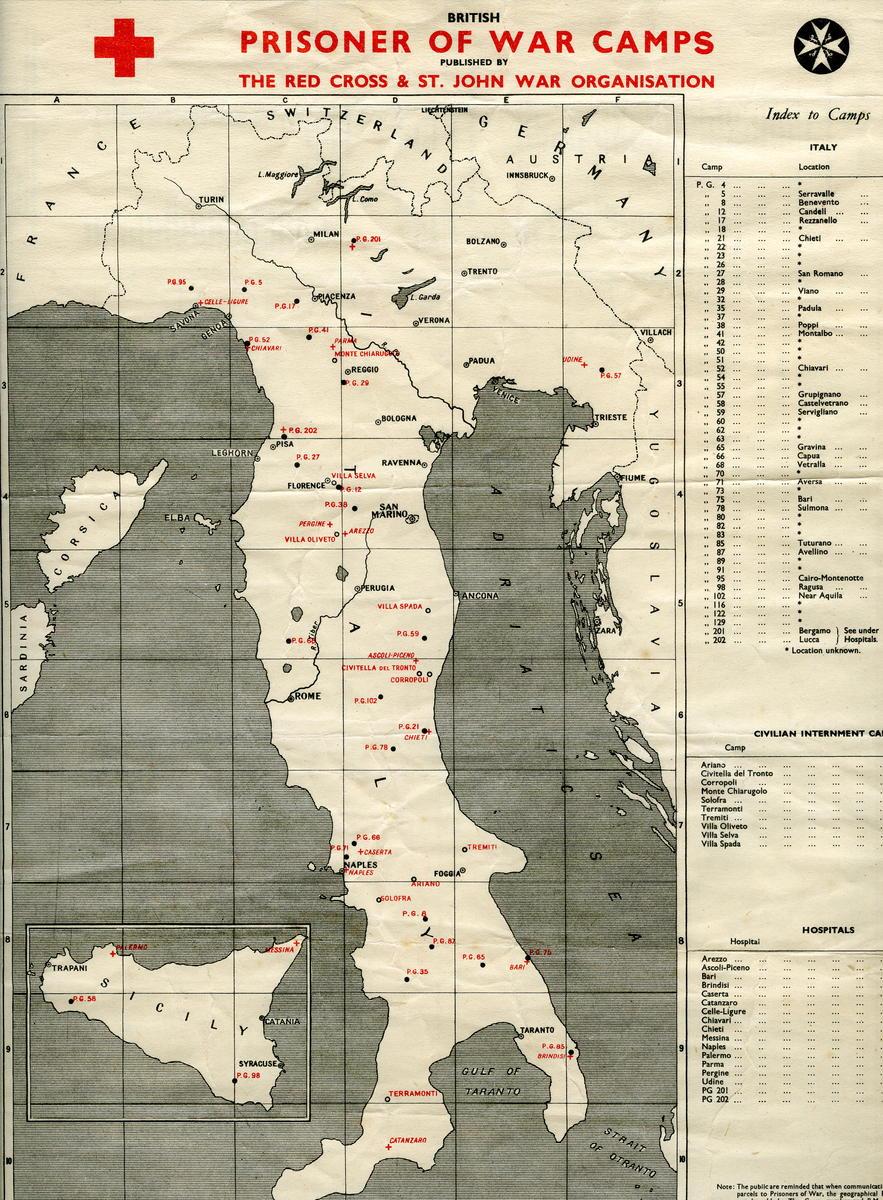
Map of British prisoner of war camps in Italy, Germany, Austria and Poland
Production date
1943
Audio tour
See full details
Details
Description
British prisoner of war camps map, locating POW camps in Germany, Austria and Poland, made by the Red Cross and St John War Organisation. Production date September 1943, during World War Two.
Throughout World War Two, German and Italian troops took over 170,000 British prisoners of war (or POWs). This is the highest number of prisoners seen taken in any conflict. These prisoners were held in a network of POW camps in Nazi-occupied territory. Here on this map, we can see the prisoner of war camps located in Germany, Austria and Poland. There are 29 POW camps, 8 civilian internment camps, and 31 hospitals associated with POW camps identified on this map. It was created in September 1943 by the Joint War Organisation which oversaw the work of the British Red Cross and the Order of St John during the Second World War.
The Prisoners of War Department of the British Red Cross packed and dispatched parcels of food and other comforts, including educational materials, to British prisoners of war. Maps like this one would have been used to locate POW camps so parcels could be sent. During World war Two, nearly 20 million standard food parcels were packed by the Joint War Organisation. Educational parcels with books and recreational parcels with sports equipment were also sent to provide the prisoners with entertainment. These parcels greatly improved the quality of life these people had during the war within these camps.
I chose this map as a symbol of the British Red Cross’ amazing work not only providing lifesaving food supplies, but also their role in keeping up the prisoner’s hope and morale within the camps.
Audio recording by Charlotte Jordan (Volunteer), Manchester.
Collection Type
Objects
Level of Current Record
item
Catalogue Number
1606/1
Subject auto tags
Object Types
Part of 1 highlight set
-1%20(002).jpg)
Share
All images are the property of the British Red Cross Museum and Archives (unless otherwise indicated), and cannot be used without permission. For queries about permission to use images, please contact enquiry@redcross.org.uk.